Facts About
The Case / Various Maps
This page is meant to log everything that is known about the case. No rumors, no theories, but facts.
-- Nancy and Joey died on December 12,
2007 - it was a Wednesday.
-- They were discovered shortly after midnight by a security guard on
December 13 in the SEARS merchandise pickup area at the Town Center
Mall.
-- They went into and came out of the SEARS/Neiman Marcus exit.
-- Security cameras on the roof of Neiman Marcus caught them arriving
at the mall at about 2:19 P.M. and leaving around 3:11 P.M. -- mid-to-late
afternoon.
-- Both were bound and shot to death from point-blank
range.
-- David Stewart (Nancy's friend of 24 years) tried to call Nancy's
cell on Thursday and a man answered it in SPANISH and hung up after
hearing Stewart's voice. He tried again on Friday and it went straight
to voicemail.
-- Nancy was bound at the neck (possibly with a plastic zip tie)
-- Nancy's purse was found in Miami's Overtown neighborhood by two homeless
men (Charles Jackson and David Goodman) and they used a credit card
found inside.
-- Nancy's cell phone was found in a lot by the old Miami Arena (1500
N.E. First Ave. in Miami), and Charles Jackson gave it to a passing
officer.
-- David Goodman was located at a Burger King at Biscayne Boulevard
and 17th Terrace in Miami.
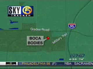
The Town Center Mall is located at 6000 West Glades Road, barely a mile
from I-95 and a transfer station for Palm Tran *AND* Broward County
Transit.
-- From the Official
MySpace Page on The Case: "On Wednesday, December 12, 2007,
Nancy and Joey entered the Mall through Entrance #4 (between the Sears
and Neiman Marcus department stores) at approximately 2:19 p.m.
They left the building through the same doors at approximately 3:11
p.m. Boca Raton investigators believe that they were abducted
and then taken to an ATM where they were forced to withdraw
$500. A 911 call from Nancy’s cellular phone
was received by the Palm Beach County Sheriff’s Office, but was
disconnected before dispatchers could answer it. The operator tried
to call back to Nancy’s phone, but received no response.
The suspect(s)
used a variety of material to bind and control Joey and Nancy,
including duct tape, plastic ties, handcuffs and goggles.
Their hands, feet, and neck were bound to restrict their movement
in the vehicle. When they were discovered, the bindings on Nancy’s
wrists were broken. There is no direct evidence to suggest
who broke the bonds or whether Nancy resisted the suspect(s) in any
way. There is no information to determine whether Nancy and Joey were
shot at the Town Center Mall or other location(s). There are no facts
available regarding when the vehicle was returned to the Town Center
Mall parking lot."

MAPS
*~ Possible Route By Car? ~*
Start: 6000 Glades Rd Boca Raton, FL 33431-7208, US End: 1500 Ne 1st Ave Miami, FL 33132-1304, US |
Directions |
Distance |
| Total Est. Time: 47 minutes Total Est. Distance: 44.72 miles | ||
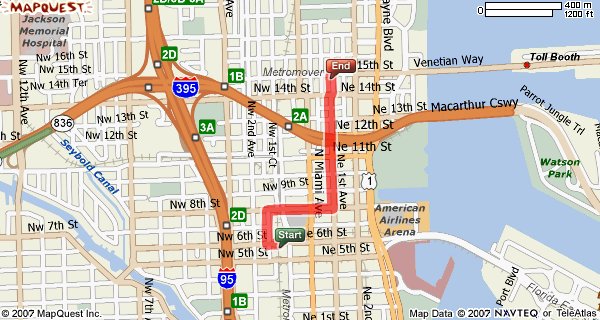
| 1: Start out
going EAST on GLADES RD / FL-808 E / SW 197TH AVE toward BUTTS RD
/ PERIMETER RD. Continue to follow GLADES RD / FL-808 E. 1.0 miles 2: Merge onto I-95 S toward MIAMI. 42.2 miles 3: Take the I-395 exit- EXIT 2D- on the LEFT toward MIAMI BEACH. 0.8 miles 4: Take the N.E. 2ND AVE. exit- EXIT 2B- toward US-1 / BISCAYNE BLVD.. 0.1 miles 5: Take the NE 2ND AVE ramp. <0.1 miles 6: Turn RIGHT onto NE 11TH ST. 0.1 miles 7: Turn RIGHT onto NE 1ST AVE. 0.3 miles 8: End at 1500 Ne 1st Ave Miami, FL 33132-1304, US |
||
From
the murder discovery site to where Nancy's purse and cell phone
were found -- is this the route he took? 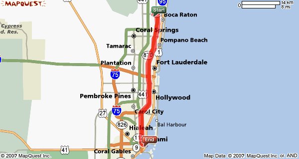 |
||
The location
of the Town Center Mall 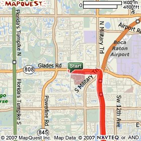 |
Maps and driving
directions courtesy of MAPQUEST. |
The location
of the empty lot 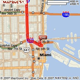 |
...OR IS THIS THE ROUTE HE TOOK?
*~ Possible Public Transportation Route -- Bus and Trains ~*
|
Directions |
Distance |
Total
Est. Time: 4 minutes Total Est. Distance: 1.01 miles |
||
| 1: Start out
going WEST on NW 6TH ST toward NW 1ST CT. <0.1 miles 2: Turn RIGHT onto NW 1ST CT. 0.1 miles 3: Turn RIGHT onto NW 8TH ST. 0.2 miles 4: Turn LEFT onto NE 1ST AVE. 0.5 miles 5: End at 1500 Ne 1st Ave Miami, FL 33132-1304, US Total Est. Time: 4 minutes Total Est. Distance: 1.01 miles |
||
For
this route, he would have had to do the following: Take the number 2 Palm Tran bus Northbound to the Boca Tri-Rail station (Yamato Road) Board the Southbound Tri-Rail and take it all the way to the Miami Airport Station (1125 E. 25 St., Hialeah) Transfer to the Metrorail and get off of the Metrorail at the Historic Overtown Station (100 NW 6th St.) Take the above directions to 1500 NE 1st Avenue. |
||
From the murder discovery site to where Nancy's purse and cell phone were found -- is this the route he took?
|
||
The location
of the Metrorail Station 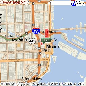
|
Maps and driving
directions courtesy of MAPQUEST. |
The location
of the empty lot 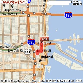 |
WPTV.com's
map from when the story first broke
|
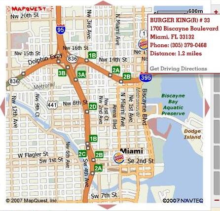
Burger King's map of their restaurant at 1700 Biscayne Blvd. 33132, where David Goodman was located.
|
Released
by the Sun-Sentinel, 2/10/08 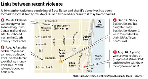 |